Property Record
815 Fowler Mill Rd, Bogart, GA 30622
NEARBY LISTINGS FOR SALE OR LEASE
Property Detail
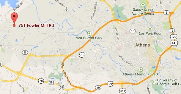
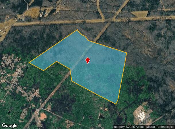
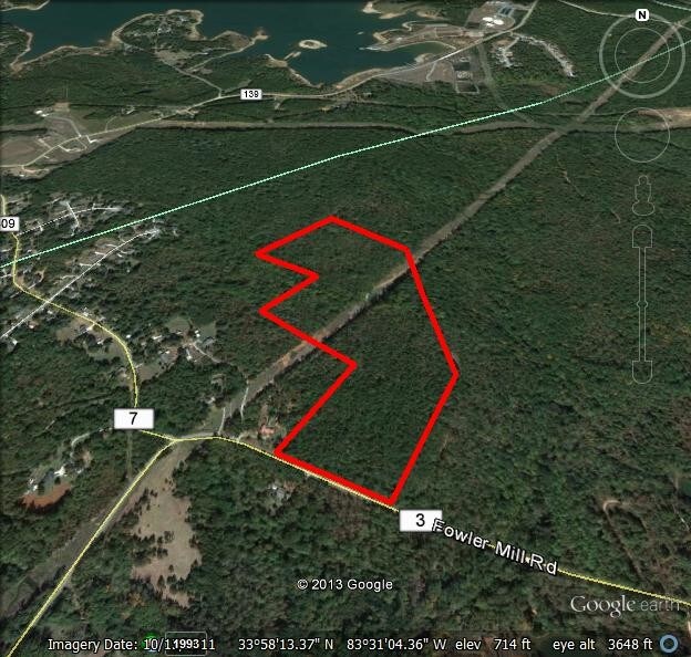
815 Fowler Mill Rd
Athens-Clarke County, GA
Res-Ma-021->100-200
033-007
DEEDED ACS: 119.970
Residentialacreage
Clarke
AE
Georgia
13013C0175D
119.97 AC
2025
Westside Athens
2025
Other Market Areas
130500
DEMOGRAPHICS near 815 Fowler Mill Rd
1 Mile
3 Mile
5 Mile
2024 Total Population
556
8,160
41,277
2029 Population
623
9,077
44,731
Pop Growth 2024-2029
+ 12.05%
+ 11.24%
+ 8.37%
Average Age
45
40
39
2024 Total Households
216
3,055
16,085
HH Growth 2024-2029
+ 10.19%
+ 10.61%
+ 7.61%
Median Household Inc
$70,065
$69,312
$71,273
Avg Household Size
2.50
2.60
2.50
2024 Avg HH Vehicles
2.00
2.00
2.00
Median Home Value
$359,999
$250,988
$272,321
Median Year Built
2001
1999
1997
Nearby Places
Map Layers
Map Styles
 Street
 Aerial
- Restaurants
- Banks
- Shops
- Fitness
- Groceries
SALE & LEASE HISTORY
LISTING DATE
SALE/LEASE

Sep 08, 2017
For Sale
Sep 06, 2017
For Sale
Nearby Properties
Address
Land Use
TOTAL SIZE
Lot Size
Zoning
Address
Land Use
TOTAL SIZE
Lot Size
Zoning
26.86 AC
G
Address
Land Use
TOTAL SIZE
Lot Size
Zoning
1 SF
126.93 AC
E-I
Address
Land Use
TOTAL SIZE
Lot Size
Zoning
425,000 SF
45.22 AC
I
Address
Land Use
TOTAL SIZE
Lot Size
Zoning
24.99 AC
G
Address
Land Use
TOTAL SIZE
Lot Size
Zoning
152,492 SF
6.49 AC
E-O
Address
Land Use
TOTAL SIZE
Lot Size
Zoning
137,764 SF
15.37 AC
C-G
Address
Land Use
TOTAL SIZE
Lot Size
Zoning
23,562 SF
30.09 AC
C-G
Address
Land Use
TOTAL SIZE
Lot Size
Zoning
199.10 AC
RS-5
Address
Land Use
TOTAL SIZE
Lot Size
Zoning
10,570 SF
10 AC
C-G
Address
Land Use
TOTAL SIZE
Lot Size
Zoning
99,600 SF
10.12 AC
001
Address
Land Use
TOTAL SIZE
Lot Size
Zoning
4,500 SF
6.06 AC
C-G
Address
Land Use
TOTAL SIZE
Lot Size
Zoning
11,060 SF
5.42 AC
Address
Land Use
TOTAL SIZE
Lot Size
Zoning
36,005 SF
4 AC
C-G
Address
Land Use
TOTAL SIZE
Lot Size
Zoning
65,761 SF
5.05 AC
C-G
Address
Land Use
TOTAL SIZE
Lot Size
Zoning
36,000 SF
0.80 AC
Address
Land Use
TOTAL SIZE
Lot Size
Zoning
147.09 AC
E-I
Address
Land Use
TOTAL SIZE
Lot Size
Zoning
36,000 SF
0.80 AC
Address
Land Use
TOTAL SIZE
Lot Size
Zoning
18,145 SF
2.96 AC
C-G
Address
Land Use
TOTAL SIZE
Lot Size
Zoning
20,568 SF
7.57 AC
G
Address
Land Use
TOTAL SIZE
Lot Size
Zoning
29,742 SF
0.76 AC
C-G
Address
Land Use
TOTAL SIZE
Lot Size
Zoning
14,629 SF
3.74 AC
C-G
Address
Land Use
TOTAL SIZE
Lot Size
Zoning
6,829 SF
5.93 AC
C-G
Address
Land Use
TOTAL SIZE
Lot Size
Zoning
12,800 SF
7.21 AC
G
Address
Land Use
TOTAL SIZE
Lot Size
Zoning
38,096 SF
2 AC
C-G
Address
Land Use
TOTAL SIZE
Lot Size
Zoning
33,900 SF
2.20 AC
C-G
Address
Land Use
TOTAL SIZE
Lot Size
Zoning
52,008 SF
7.38 AC
C-G
Address
Land Use
TOTAL SIZE
Lot Size
Zoning
16,870 SF
4.17 AC
C-G
Address
Land Use
TOTAL SIZE
Lot Size
Zoning
37,005 SF
4.01 AC
C-G
Address
Land Use
TOTAL SIZE
Lot Size
Zoning
60.25 AC
E-I
Address
Land Use
TOTAL SIZE
Lot Size
Zoning
188.65 AC
001
The World's #1 Commercial Real Estate Marketplace
Connect with us
© 2026 CoStar Group
The information above has been obtained from sources believed reliable. While we do not doubt its accuracy we have not verified it and make no guarantee, warranty or representation about it. It is your responsibility to independently confirm its accuracy and completeness. Any projections, opinions, assumptions, or estimates used are for example only and do not represent the current or future performance of the property. The value of this transaction to you depends on tax and other factors which should be evaluated by your tax, financial, and legal advisors. You and your advisors should conduct a careful, independent investigation of the property to determine to your satisfaction the suitability of the property for your needs.